
North Texas Bypasses Storm: DFW Stays Dry While South Floods
Flash floods hit the Rio Grande Valley as the metroplex enjoys dry skies and a midweek temperature spike.
By Adriana Abebe ·
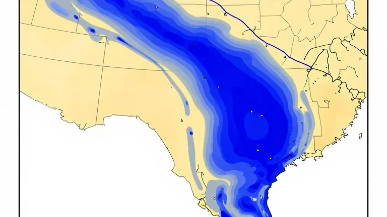
A slow-moving low-pressure system originating in northwestern Mexico has triggered heavy downpours and flash flood warnings across Central and South Texas. While regions near Corpus Christi face severe water accumulation, the Dallas-Fort Worth metroplex is largely spared from the deluge. Local forecasters report that overnight showers dissipated by Sunday morning, leaving only light, scattered moisture between Freestone and Anderson counties.
Drivers traveling south of Interstate 20 in southern Tarrant and Dallas counties were advised to proceed with caution due to potentially slick road surfaces. Despite dense overcast skies, North Texas temperatures remained seasonable on Sunday afternoon. Highs reached the upper 60s to lower 70s, offering a comfortable contrast to the wet conditions in the south.
Warmer air returns with southerly winds on Monday, pushing highs into the low-to-mid 70s under continued mostly cloudy skies. A slight 20% chance of isolated, pop-up showers exists for northern counties on Tuesday as the low-pressure system shifts northeast. Rainfall totals for these isolated events are expected to remain minimal.
A warming trend peaks Wednesday afternoon, with temperatures reaching near 78 degrees ahead of an approaching cold front. The front is projected to move through Thursday afternoon into Friday, bringing a dry passage with no expected rainfall. Northerly winds behind the front will clear out the clouds and usher in cooler air by Friday afternoon.
Daytime highs will hold below 70 degrees, while morning lows drop into the upper 40s heading into the weekend. The weather pattern confirms a sharp contrast between the flood-stricken south and the dry, warming north, with the cold front marking the end of the midweek heat spike.